Scientists Just Discovered a Hidden Freshwater World Beneath the Great Salt Lake
Scientists found extensive freshwater beneath the Great Salt Lake, offering new insights into groundwater flow and potential environmental solutions.
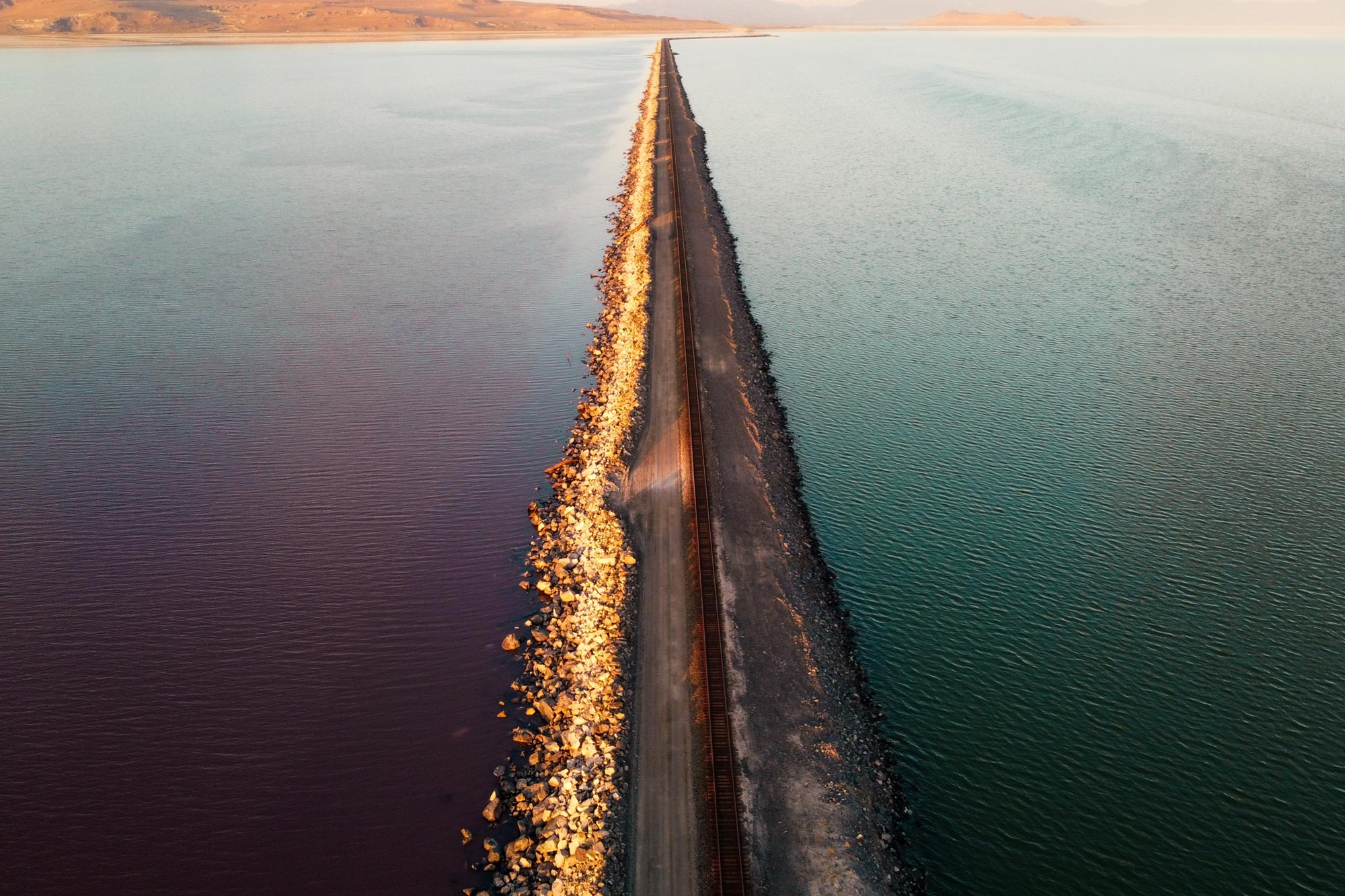
A new study is shedding light on what could be a vast underground freshwater reservoir beneath the Great Salt Lake. Researchers used airborne electromagnetic (AEM) surveys to image geologic structures below Farmington Bay and Antelope Island along the lake’s southeastern shore.
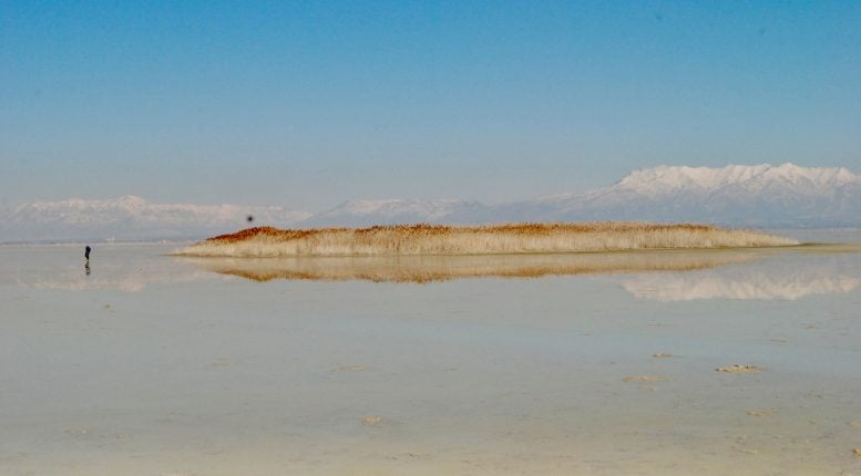
Geophysicists at the University of Utah analyzed the data and found that freshwater saturates sediments beneath the lake’s highly salty surface at depths of 3 to 4 kilometers (about 1.9 to 2.5 miles, or 10,000 to 13,000 feet). The helicopter-based survey followed earlier observations of freshwater rising under pressure at several locations on the exposed lakebed in Farmington Bay, forming unusual mounds covered in dense phragmites reeds.
According to lead author Michael Zhdanov, the study is the first to show that AEM methods can detect freshwater beneath the thin, conductive saltwater layer at the lake’s surface. His team also mapped how far the freshwater extends beneath Farmington Bay and estimated the depth of water-saturated sediments by identifying the underlying basement structure.
Mapping Depth, Volume, and Extent
“We were able to answer the question of how deep this potential reservoir is and what is its spatial extent beneath the eastern lake margin. If you know how deep, you know how wide, you know the porous space, you can calculate the potential freshwater volume,” said Zhdanov, a distinguished professor of geology & geophysics and director of the Consortium for Electromagnetic Modeling and Inversion, or CEMI.
The findings were published in the Nature-affiliated journal Scientific Reports. The work is part of a broader project led by the University of Utah’s Department of Geology & Geophysics and supported by the Utah Department of Natural Resources to better understand groundwater beneath the Great Salt Lake, the largest terminal lake in the Western Hemisphere.
Led by senior faculty and graduate students, the project has already produced two additional papers, with more expected.
Unexpected Freshwater Flow Patterns
The results suggest that freshwater is moving into the subsurface toward the lake’s interior rather than entering from the edges, which is what scientists would typically expect, according to hydrologist Bill Johnson, a co-author on the studies.
“The unexpected part of this wasn’t the salt lens that we see near the surface across the playa. It’s that the freshwater underneath it extends so far in towards the interior of the lake and possibly under the entire lake. We don’t know,” Johnson said on a recent appearance on KPCW’s Cool Science Radio show. “What we would normally expect as hydrologists is that that brine would occupy the entire volume underneath that lake. It’s denser than the freshwater. You’d expect the freshwater from the mountains to come in somewhere at the periphery. But we find it’s coming in towards the interior. And there’s what appears to be deep volume of this freshwater coming in underneath that saline lens.”
Interest in the phenomenon grew after circular mounds began appearing on the dried lakebed recently. Each mound measures about 50 to 100 meters (roughly 164 to 328 feet) across and is covered with reeds up to 15 feet tall. Falling water levels have exposed around 800 square miles of lakebed, now a significant source of dust pollution affecting nearby communities in Utah.
Environmental Impacts and Practical Uses
Johnson, a professor of geology and geophysics, is exploring whether this artesian groundwater could be used to reduce dust emissions that contain toxic metals.
“There are beneficial effects of this groundwater that we need to understand before we go extracting more of it. A first-order objective is to understand whether we could use this freshwater to wet dust hotspots and douse them in a meaningful way without perturbing the freshwater system too much,” Johnson said. “To me, that’s a primary objective because it’s very practical, and it’s unlikely we’ll be able to fill Farmington Bay and other parts of the playa enough to avoid some dust spots appearing at the higher elevations. This would be a great way to get at that.”
Johnson and colleagues, including Mike Thorne and Kip Solomon, are seeking funding to expand the research across a larger area of the lake.
Airborne Surveys and Data Collection
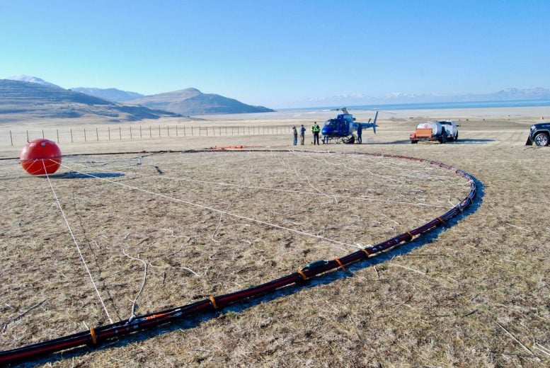
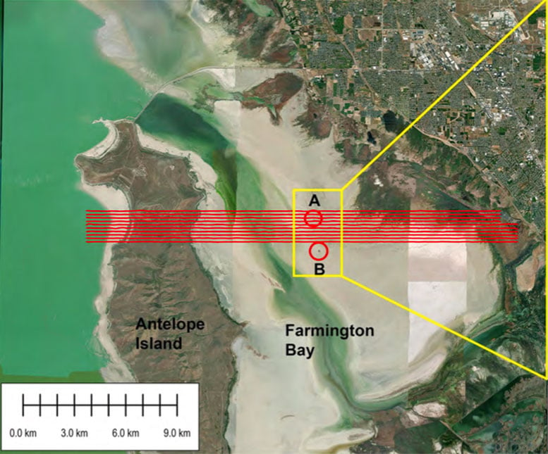
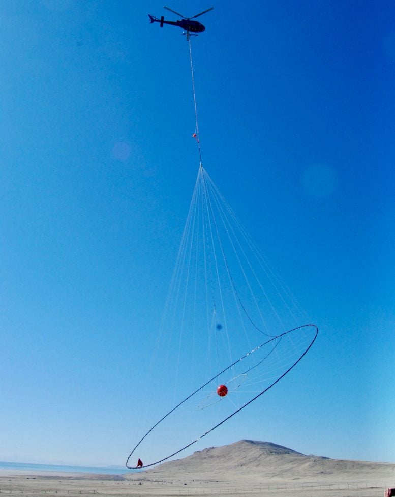
The study measured electrical resistivity down to about 100 meters (approximately 328 feet) using airborne electromagnetic surveys to distinguish freshwater from more conductive brine. To carry out the work, Johnson and Zhdanov hired a Canadian geophysical team to fly equipment suspended beneath a helicopter in February 2025. The aircraft completed 10 east-to-west survey lines across Farmington Bay and the northern part of Antelope Island, covering 154 miles.
The data allowed researchers to map the boundary between saltwater and freshwater. One phragmites mound, for example, sits above a location where freshwater rises through a break in the otherwise impermeable layer beneath the lake.
“Red means very conductive, blue is resistive,” Zhdanov said while explaining the map. “You clearly see near surface is saline water, 10 meters underneath is resistive freshwater. You see clearly it’s everywhere.”
3D Imaging and Subsurface Insights
Zhdanov’s team at CEMI has developed a method for creating three-dimensional images of the subsurface by combining airborne electromagnetic data with magnetic measurements. In this study, the approach produced a detailed tomographic image extending deep beneath Farmington Bay, revealing key features of its geology and groundwater system.
Magnetic data show that the basement beneath the Farmington Bay playa is relatively shallow, less than 200 meters (about 656 feet) deep, before dropping sharply to 3 to 4 kilometers (about 1.9 to 2.5 miles). This transition occurs beneath a phragmites mound and marks a major structural boundary that warrants further study.
“This is why we need to survey the entire Great Salt Lake. Then we’ll know the top and the bottom,” Zhdanov said. “To study the top, we use airborne electromagnetic methods, which gives us the thickness of the saline layer and where the freshwater starts under the saline layer. To study the bottom, we use magnetic data. We use different techniques to study the vertical extent of this freshwater-saturated sediments to find the depth to the basement.”
Future Research and Broader Applications
Although this initial study covered only a small portion of the lake, Zhdanov believes similar airborne surveys could span the entire 1,500 square miles.
A full survey could support regional water resource planning and help guide efforts to locate freshwater beneath terminal lakes around the world.
Reference: “Airborne geophysical imaging of freshwater reservoir beneath the eastern margin of Great Salt Lake” by M. S. Zhdanov, M. Jorgensen, L. Cox, W. P. Johnson and D. K. Solomon, 27 February 2026, Scientific Reports.
DOI: 10.1038/s41598-026-40995-5
Funding for this study came from the Utah Department of Natural Resources, the Great Salt Lake Commissioners’ Office, and the Consortium for Electromagnetic Modeling and Inversion (CEMI) at the University of Utah.
Never miss a breakthrough: Join the SciTechDaily newsletter.
Follow us on Google and Google News.
Source link