In an evolving health landscape, emerging research continues to highlight concerns that could impact everyday wellbeing. Here’s the key update you should know about:
By combining geospatial modeling with real test flights, researchers show how drones could bypass flooded roads and isolated coastlines to deliver lifesaving medications where traditional healthcare falls short.
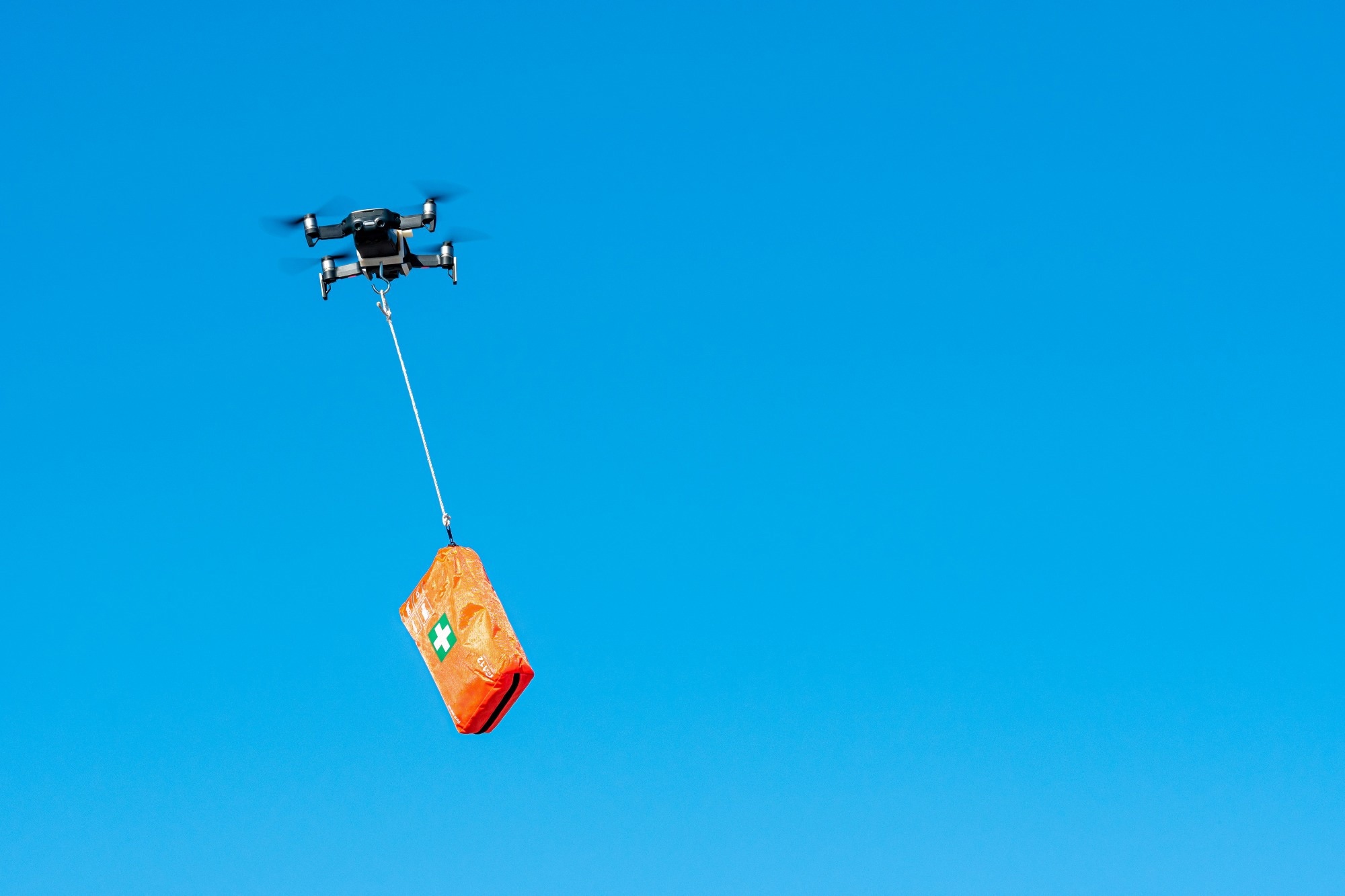
Study: Drone-based medication delivery for rural, flood-prone coastal communities. Image Credit: ako photography / Shutterstock
In a recent article in the journal PLoS One, researchers at Old Dominion University, USA, assessed the process of delivering medications through drones to people in rural and flood-prone coastal regions in the U.S. state of Virginia. Compared to patients traveling by car, which can take up to 50 minutes to collect medications, the study modeled that drone delivery takes 10 minutes or less and could significantly improve access for elderly and vulnerable people living in medically underserved areas.
Background
Rural and flood-prone coastal areas face persistent barriers to healthcare, especially when transportation disruptions hinder access to essential medications. These challenges disproportionately affect vulnerable populations such as the elderly, worsening existing health inequities.
In the U.S., around 80% of rural residents live in medically underserved areas. They experience limited access to pharmacies compared with urban populations. Transportation issues, poor infrastructure, and frequent extreme weather events further restrict timely access to care. For older adults, a lack of reliable transport due to disability, income, or age can mean missed treatments and reduced independence.
Flood-prone coastal regions are particularly at risk, as rising sea levels and storm-related flooding can isolate communities for days. Previous disasters, such as cyclones in Mozambique and flooding in Japan, have demonstrated how severe weather can disrupt healthcare continuity.
In this context, drone technology offers a promising solution. It provides faster, more reliable, and scalable delivery of medical supplies. While drone delivery has been used in emergency or experimental settings, its role in routine healthcare for rural and flood-affected communities remains underexplored.
About the Study
The study focused on the Eastern Shore of Virginia. This region is geographically isolated, flood-prone, and has limited healthcare infrastructure. Only seven pharmacies serve over 2,600 km².
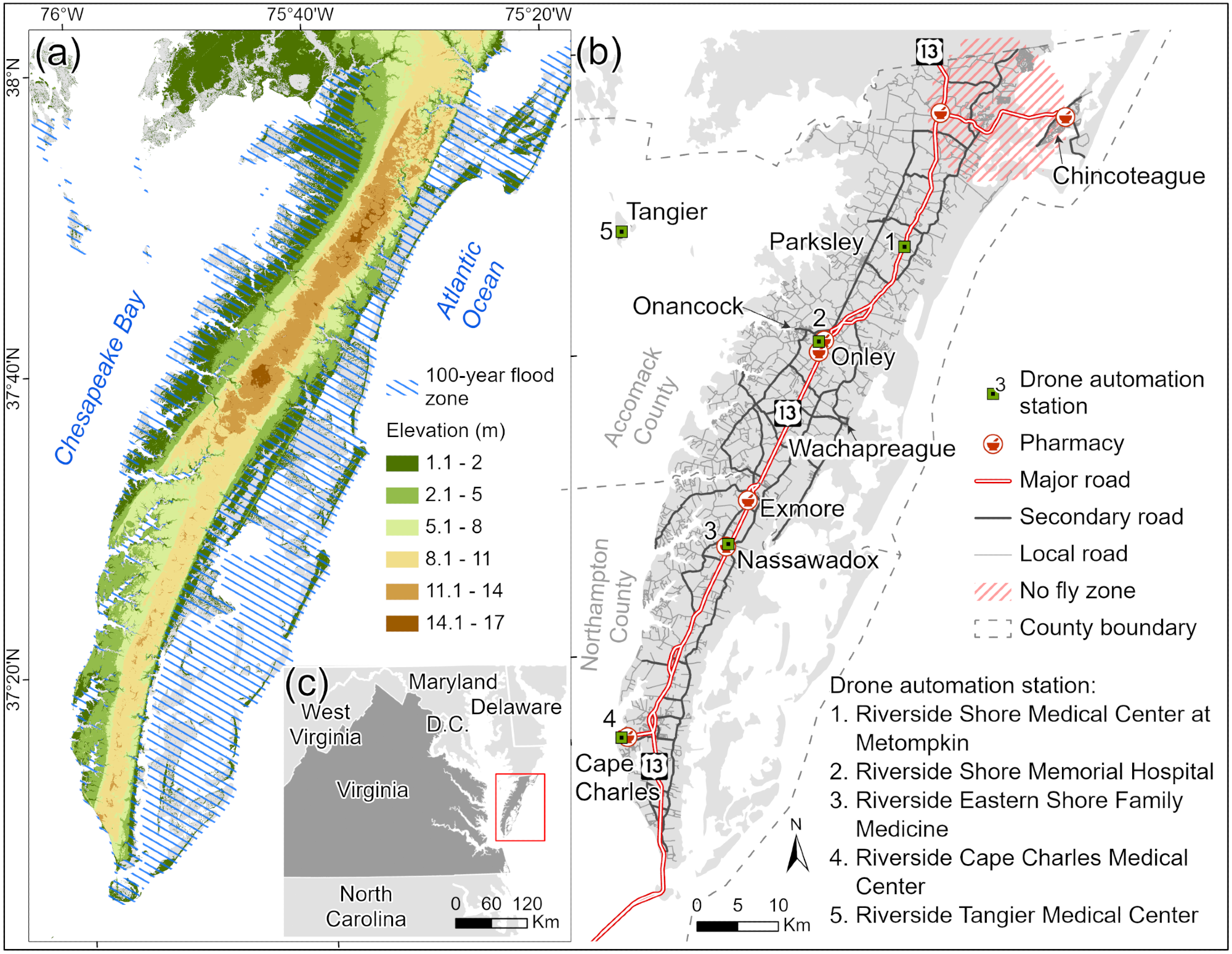

A side-by-side map showing the 100-year flood zone along the elevation relief of Eastern Shore (ES) of Virgina (a), as well as the locations of drone stations, pharmacies, and the road network with elevation relief (b). The inset map (c) highlights the study area’s relative location on the Eastern Coast of the U.S., indicated by a red rectangle.
Researchers used publicly available geospatial data to map pharmacies, drone stations, and population distributions, prioritizing elderly residents due to their higher rates of hypertension. To ensure privacy and replicability, no personal medical data were used.
First, they estimated population density and age distributions at the building level. Network analyses compared travel zones for personal vehicles (round trips to the nearest pharmacy) with one-way drone deliveries from five drone hubs. Drone delivery times were calculated using distance, speed (22.35 m/s), and loading/unloading durations.
Two patient vulnerability indices were created: one based on age and travel time (VAT) and another that added flood exposure (VATF). Hot spot analyses identified clusters of high-need patients, especially those in remote or flood-affected areas.
The study also integrated regulatory and operational considerations for drone delivery, ensuring compliance and collaboration with healthcare providers. At present, operations require visual observers, and the research team notes that beyond-visual-line-of-sight approval is being pursued to expand future scalability. In addition, 352 test flights were conducted to validate operational feasibility and inform modeled assumptions. The research team hopes that this methodological framework offers a scalable and data-driven approach to assessing how drone networks can enhance healthcare resilience in underserved, disaster-prone regions.
Key Findings
Drone delivery dramatically improved access to medications compared with vehicle travel on the Eastern Shore. Over 80% of residents could receive medications within 10 minutes via drone, while less than 38% could complete a round trip to a pharmacy in the same time by car.
In remote areas, vehicle travel required up to 50 minutes, whereas drones reached even isolated regions like Tangier Island in approximately 15 minutes during test flights. Faster delivery is possible if an on-island hub were established. Although no-fly zones restricted coverage in northeastern regions, more than 99% of residents could still be served within 30 minutes by drone. However, around 7,749 residents, including 2,943 aged 60 years or older, were excluded from drone coverage because they live in restricted airspace.
Spatial vulnerability analyses further revealed disparities in healthcare access. The two indices, VAT (age and travel time) and VATF (adding flood exposure), showed that high-risk “hot spots” were concentrated along the western coast and low-lying, flood-prone zones.
Northern drone stations served larger populations with higher vulnerability scores, particularly Station 1, which covered Chincoteague and other isolated coastal communities. In contrast, southern stations served fewer, less vulnerable residents.
Overall, drones offered faster, more reliable access for older and mobility-limited patients, significantly reducing disparities in healthcare accessibility across geographically and environmentally challenging regions. The findings are based on modeled travel times rather than measured patient outcomes.
Conclusions
The study demonstrates that drone-based medication delivery can substantially reduce travel times and improve healthcare access for vulnerable rural and flood-prone populations.
Drones outperform vehicles by bypassing poor road networks and flood barriers, providing rapid, equitable service to isolated areas such as remote islands and coastal communities. The vulnerability indices effectively identified high-risk regions, offering a scalable, data-driven framework to guide strategic drone deployment.
Strengths include the use of publicly available data, a reproducible geospatial approach, and integration of flood exposure in vulnerability assessment. However, limitations include simplified travel-time estimates, static drone speeds, and restricted no-fly zones that leave some residents unserved. The authors also note that the study modeled rather than observed travel behaviors, that drone flight paths and speeds were fixed, and that operational constraints remain due to regulatory requirements. They further suggest exploring AI-enabled routing and coordinated multi-drone networks to optimize delivery efficiency in future systems.
Future studies should incorporate real-world driving behavior, adaptive drone routing, and alternative delivery modes like truck-based drones. They also suggest exploring AI-enabled logistics and multi-drone networks that could cement the role of drones as a scalable, sustainable, and equitable solution to enhance medication access and healthcare resilience in underserved, flood-prone regions.
Journal reference:
- Chen, Y., El-Adle, A.M., O’Brien, K.J., Wentworth, T., Richter, H.G. (2025). Drone-based medication delivery for rural, flood-prone coastal communities. PLoS One, 20(10): e0333696. DOI: 10.1371/journal.pone.0333696, https://journals.plos.org/plosone/article?id=10.1371/journal.pone.0333696
-

-
-

-

-