

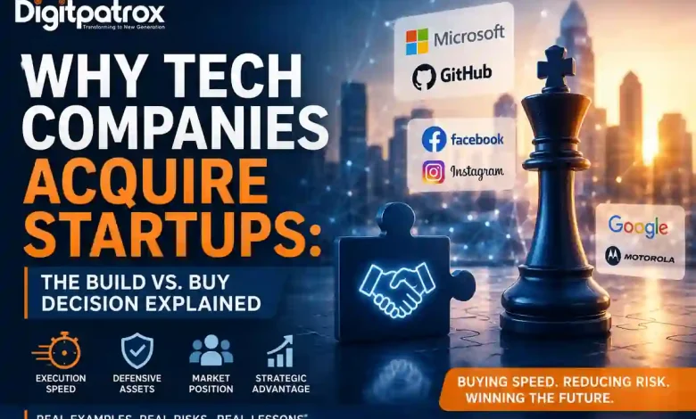
Why Tech Companies Acquire Startups: The Build vs. Buy Decision Explained
Discover why companies like Microsoft, Google, and Facebook acquire startups instead of building products internally-and how speed, strategy, and execution shape billion-dollar deals.
Why Tech Companies Acquire Startups: The True Cost of Build vs. Buy
In 2018, Microsoft paid $7.5 billion to acquire GitHub. It wasn’t buying a Git hosting service; it was buying the trust of millions of developers and a central position in the modern software ecosystem. This decision illustrates a broader pattern: the largest technology acquisitions are rarely about code alone. They are about buying speed, defensive assets, and market position when building from scratch is too slow or too risky.
Executive Reality Check
-
Coordination Costs: Large companies often buy startups not because their internal engineers lack capability, but because corporate governance structures destroy deployment speed.
-
Integration Risk: Significant product value is routinely lost in the first year due to forced cloud migrations, mandatory security rewrites, and developer attrition.
-
Strategic Value: Successful technical acquisitions target products that provide a defensible asset, such as a strong user network, developer mindshare, or essential IP that is difficult and time-consuming to recreate.
1. The Coordination Tax: Why Internal R&D Stagnates
Large technology companies rarely fail to innovate due to a lack of talent. Their primary constraint is the coordination tax that scale imposes on the engineering pipeline. In a startup, a team can identify a requirement, design a feature, and push code to production in days.
In contrast, mature enterprises introduce numerous stakeholders into the development lifecycle. A new feature must pass through security reviews, legal verifications, and architectural committees. While each of these gates is individually reasonable to protect the core business, they dramatically increase the cost of coordination.
Startup Decision Path:
[Team] ⟶ [Deploy]

Enterprise Decision Path:
[Team] ⟶ [Security]
        ⟶ [Legal]
        ⟶ [Architecture]
        ⟶ [Governance] ⟶ [Deploy]
When development cycles stretch from weeks into quarters, a company’s roadmap falls behind shifting market conditions. Acquiring a startup allows an enterprise to shorten its product roadmap by integrating an existing solution into its business instead of building one from scratch.
2. Risk Mitigation: The Financial Calculus
Building software involves significant economic uncertainty. A corporate project can consume millions in capital and years of developer time, only to miss its market window. By purchasing an active product with a verified customer base, a company shifts its risk from execution to integration.
The economic rationale is driven by clear operational metrics:
-
Customer Acquisition Cost (CAC) Payback: A startup has already absorbed the inefficient early costs required to win its first cohort of customers.
-
Time-to-Revenue Acceleration: An internal project yields zero revenue during its R&D phase. An acquisition can provide an existing customer base and revenue stream immediately after closing.
-
Opportunity Cost: Engineering resources diverted to build a copycat solution could instead be deployed to optimize the company’s core, highly profitable lines of business.
When an enterprise needs to upgrade its backend architecture-such as implementing modern vector search-building a native platform is difficult. Instead of absorbing the deep optimization risks and long development times required to engineer these systems natively, corporate teams often acquire specialized vector databases that have already proven reliable under real workloads.
3. Why Microsoft, Google, and Facebook Choose to Buy
Successful acquisitions target assets that cannot be replicated through simple hiring.
-
Facebook & Instagram (2012): While Facebook had the engineering resources to build a competing photo-sharing application, recreating Instagram’s community and growth trajectory would have been far more difficult. Facebook bought a rapidly scaling mobile network effect that was already winning.
-
Microsoft & GitHub (2018): Microsoft bought GitHub to secure its role as the definitive home for the global open-source community. Beyond developer trust, the deal reinforced Microsoft’s shift toward open-source software and significantly bolstered Azure’s adoption among developers.
-
Google & Motorola (2012): Google acquired Motorola largely for its patent portfolio, while also gaining hardware expertise and additional leverage within the Android ecosystem.
4. The Anatomy of Acquisition Failures
Technical history is filled with acquisitions that destroyed economic value when the buyer failed to understand the target or forced an unworkable operating model onto them.
| Acquisition Deal | Primary Failure Mechanism | The Operational Reality |
| HP & Autonomy (2011) | Due Diligence Failure | HP rushed the analysis, failing to detect discrepancies in software revenue recognition. This led to an $8.8 billion write-down within a year. |
| Microsoft & Nokia (2013) | Cultural/Strategic Mismatch | Microsoft attempted to buy its way into mobile by merging a rigid hardware manufacturer with a lagging OS, failing to compete with open platforms. |
| Yahoo & Tumblr (2013) | Monetization Misalignment | Yahoo forced corporate ad-sales targets onto an expressive user base, entangling the platform in bureaucracy and causing a massive loss of engagement. |
These failures demonstrate that capital alone cannot force integration. If the acquiring company does not respect the cultural and technical boundaries of the company they buy, the talent departs and the product stagnates.
5. When You Should Not Buy
Acquisitions are not a universal solution. An organization should commit to building internally when:
-
The Capability is Core IP: If a feature defines the company’s primary competitive advantage, outsourcing it introduces long-term platform risk.
-
Integration Costs Exceed Development Costs: If a startup’s software architecture is incompatible with the buyer’s stack, rewriting the code to pass security compliance can take longer than building it from scratch.
-
The Technology Lacks a Defensible Asset: If a feature can be replicated relatively quickly by an internal engineering team, an acquisition premium is an inefficient use of capital.
The Integration Playbook
Stage 1: The Isolation Period (Days 1–90)
-
Freeze the Deployment Cadence: Keep the startup’s core codebase and deployment pipelines separate from corporate release gates. Do not modify the environment during this transition.
-
Appoint a Liaison: Assign one technical liaison to filter all corporate requests, protecting the core engineering team from alignment meetings.
Stage 2: Background Compliance (Days 90–180)
-
Perimeter Security: Implement enterprise authentication protocols only at the exterior boundaries, ensuring core application performance remains unaffected. Learn more about structural authentication needs in our deep-dive on OAuth architectures.
-
Asynchronous Auditing: Deliver security remediation requests as a prioritized engineering backlog rather than forcing an immediate product freeze.
Stage 3: Value-Driven Integration (Days 180+)
-
Optional Migration: Move workflows to corporate infrastructure only when it solves a scaling bottleneck or reduces operating costs.
-
Monitor Velocity: Continually review pull-request-to-production speed. If compliance overhead slows the team, simplify the administrative steps required to ship.
Technical Acquisition FAQ
1. Why don’t large tech firms just duplicate a startup’s features?
Copying features doesn’t replicate the execution speed behind them. An internal project lacks the domain knowledge and complete focus of the original team. By the time the enterprise version clears internal testing, the market has often moved.
2. What is the most common reason an acquisition fails?
Architectural rejection. Forcing a modern, lightweight software stack into a rigid corporate deployment cadence stalls momentum. The product stops improving and the developers leave.
3. How do compliance requirements impact an acquired startup’s roadmap?
They pull focus away from user-facing features. The startup must spend engineering cycles migrating databases, rewriting data access controls, and implementing corporate logging tools instead of building.
4. Is an acquihire cost-effective?
The initial cost is higher than standard recruiting. However, when you account for the value of an aligned team that already knows how to collaborate and ship production-grade code, it is often more efficient for high-priority initiatives.
5. How do acquisitions alter a platform ecosystem?
A successful acquisition acts as an accelerant. It fills a critical gap in the product suite, allowing for a more complete solution while bringing fresh development practices into the wider organization.
Further Reading & References
-
Microsoft & GitHub: Microsoft + GitHub = Empowering Developers (Official Acquisition Announcement, 2018).
-
Facebook & Instagram: Anticipated acquisition by Facebook Inc of Instagram Inc (Office of Fair Trading Merger Case Decision, 2012).
-
Google & Motorola Mobility: Google to Acquire Motorola Mobility (Joint Press Release via SEC Edgar, 2011).
-
HP & Autonomy: HP Shareholder Derivative Litigation Regarding Autonomy Valuation (Notice of Settlement Filings via SEC Edgar, 2015).
-
Developer Environment Efficiency: Cursor vs Windsurf vs Claude Code Portfolio Analysis (Digitpatrox Engineering Workflows, 2026).